Home   Back To Mountain Selection   Glossary
Glyder Fawr & Tryfan
Quick Facts
This is the summed total of all the climbing within a route and is a good indicator of the strenuousness of a route.
Total Ascent
2788 ft

An estimate of the time taken based on a derivation of Naismiths rules. Our calculation is based on the horizontal and ascent components of a climb, we do not make a reduction for descent.

Registered users can customise these walking times by specifying their own walking and ascending speeds. They can also add a fixed time period for stoppages.

Route Time
3 hrs
The horizontal distance of the route.
Route Distance
4.6 ml
 

The UK is covered by 204 Ordnance Survey Landranger 1:50,000 scale maps. Maps numbered 1 to 86 cover Scotland but for the highest mountains (Munros) only 23 maps are required. The name given roughly describes the area covered by the map.

You can click on the map name to purchase the map for £6.29 including postage which is one of the cheapest prices we have found.


OS Landranger Maps Required
  115   Snowdon & Caernarfon
Only £6.29  (£13.49 Laminated) from  

A brief summary of this route.

Our summary will always contain one of easy, moderate or hard to indicate the severity of the route.

 Notes
Moderate route passing near crags, mostly on grass, fairly steep stony slopes and broad boulder-strewn ridges. ‘Bristly Ridge’ is a time-consuming scramble through many slabs of upended rock, but can be avoided on a track up the slope further east.

Here we provide the nearest town to the start of the route where you will find basic services.

We then give directions from that location to the route start. Your approach route may differ.

 Travel Information

Head to: Capel Curig

From Capel Curig drive NW on A5 about 8km to W end of Llyn Ogwen and park near Idwal Cottage.

Route Waypoint Map

The total ascent is 2,788 feet. Allow 3 hours to complete this 4.6 mile route.

Usually the shortest way to climb the mountain, making best use of tracks and paths to gain altitude. Route navigation requires map reading skills and an ability to navigate with a compass.

The information given here will enable you to annotate your map and plan your route. We do not give anecdotal descriptions on where to find the paths, worn by the feet of previous mountaineers.

Where the access routes are few or the ridge is narrow, paths are generally obvious. On open ground, following paths without using your compass may get you lost in poor visibility.

 Route Information
Waypoint Detail
  Park at W end of Llyn Ogwen near Idwal Cottage
  SH64846042 Distance
Altitude
1013 ft
1
Ascend on track SE to Llyn Bochlwyd
SH65545942 Distance
0.8 miles
Altitude
1804 ft
2
Continue ascent SE to broad col.
SH66175889 Distance
0.5 miles
Altitude
2365 ft
3
Ascend NNE to summit of Tryfan (3000ft+)
SH66385940 Distance
0.4 miles
Altitude
3001 ft
4
Retrace route SSW to col
SH66175889 Distance
0.4 miles
Altitude
2378 ft
5
Continue SSW and join path at base of Glyder Fach N ridge
SH66145878 Distance
0.1 miles
Altitude
2391 ft
6
Scramble SSW up ridge (or easier path E of crest)
SH65965846 Distance
0.3 miles
Altitude
3100 ft
7
Continue WSW to Glyder Fach
SH65645829 Distance
0.2 miles
Altitude
3261 ft
8
Descend W on path to col
SH65255820 Distance
0.3 miles
Altitude
2962 ft
9
Continue WNW to junction of paths at the head of Y Gribin ridge
SH65055825 Distance
0.1 miles
Altitude
3133 ft
10
Follow path WSW along ridge to col
SH64765804 Distance
0.2 miles
Altitude
3136 ft
11
Continue W to Glyder Fawr (3000ft+)
SH64255796 Distance
0.3 miles
Altitude
3277 ft
12
Descend W turning NW to 900m contour
SH63885812 Distance
0.3 miles
Altitude
2952 ft
13
Descend N to junction of paths near Llyn y Cwn
SH63815854 Distance
0.3 miles
Altitude
2352 ft
14
Descend NNE on path W of Llyn Idwal to reach N end of Llyn
SH64425991 Distance
0.1 miles
Altitude
1220 ft
15
Continue descent NE to start
SH64846042 Distance
0.5 miles
Altitude
1013 ft

A selection of weather forecasts local to this route.

 Weather
Snowdonia
by MWIS (PDF format)
Snowdonia
by Met Office
Glyder Fawr
by Metcheck
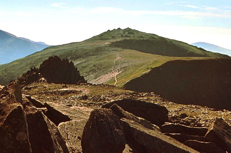
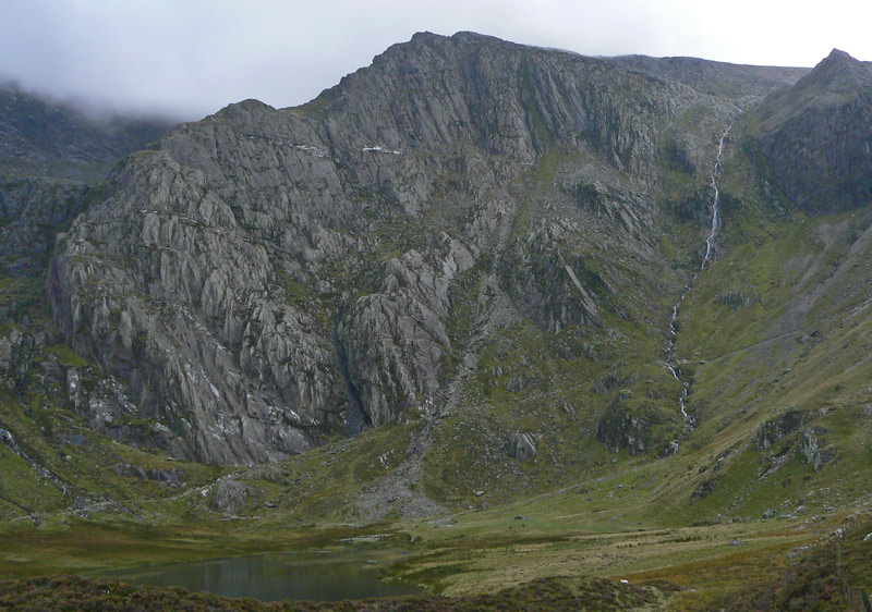
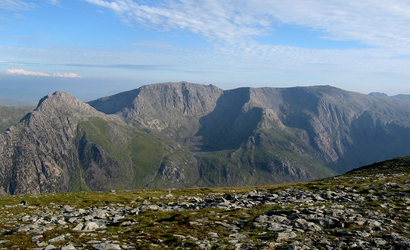
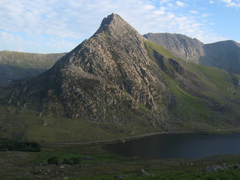
Images of Glyder Fawr & Tryfan
Route Area Map
Legend  Munro  Corbett  Graham  English/Welsh Top  Accommodation

A selection of local accommodation options who advertise with Munromagic.com.

 Where to Stay
We currently have no
sponsored accommodation listings for this area.

Rating & Reviews

 Rating & Reviews
Rated:
 from 1 vote
Click Stars to Vote
Your Rating
Disclaimer. The details provided above are an aid to planning an expedition, but all distances, altitudes and bearings must be considered approximate. You must navigate with the appropriate map, a compass, your navigation skills and common sense, MunroMagic.com accept no responsibility for your interpretation of our route information.
Privacy Policy Cookie Policy Contact Us